Historic Flood - 2011
In late October 2010, southern Manitoba was within a millimetre of having its wettest year on record, when a super-charged weather bomb dumped 50 to 100 millimetres of rain and snow. At freeze-up, soil moisture levels were the second highest since 1948; only 2009 had more. Cold temperatures throughout the winter resulted in deep soil frost penetration, meaning spring melt water was likely to spread out instead of soaking in. At the season's midpoint, the snowfall total was at a 15 year high.
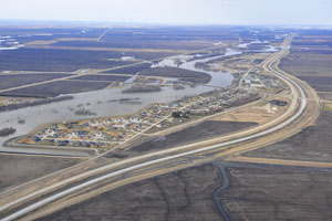
When spring arrived, cold temperatures slowed the melt and delayed expected flooding. By mid-April, there was still plenty of snow on the ground and nowhere for the water to go when it melted. Then came heavy spring precipitation, with rain and snow that added to an already bad flooding situation. Waters rose steadily in several lakes and in rivers including the Red, Assiniboine, Souris, Pembina and Qu'Appelle.
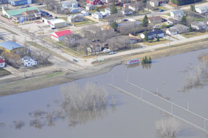
In early April 2011, Manitoba declared a high flood risk for six rivers, including two that pass through Winnipeg. The Red River peaked in Winnipeg on April 7, when an ice jam drove up water levels. The high stage ranked third largest in the past 150 years. The Assiniboine River crested just days later.
Once again, the Red River Floodway saved the day, along with some help from nature when no major rain or snow fell in the area during April, May or June.
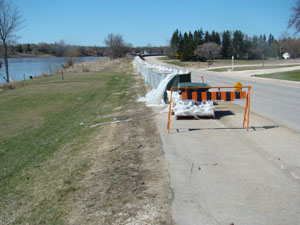
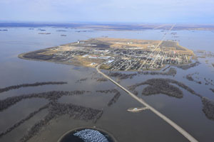
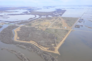
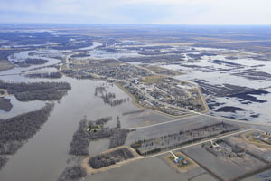
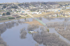
On May 9, the Manitoba government declared a province-wide state of emergency, issuing evacuation notices for several municipalities along the Assiniboine River. Brandon was at the epicentre of a months-long flood battle, in which the Assiniboine River reached its highest level since 1923 and continued to rise. The river was nearly seven metres higher and 20 to 30 times wider than normal in some places. Flooding on the Assiniboine near Brandon lasted 120 days and was the largest on record.
In late May, Lake Manitoba, Lake Winnipeg and at least four others reached record water levels. Hundreds of residents and cottage owners were ordered to leave because of high winds and waves. Lake levels were higher than 1955 levels that were previously the highest recorded levels. The 2011 levels were enhanced by water diverted from the Assiniboine River. A late May 2011 storm with strong north winds sent water crashing against dozens of homes at Delta Beach on the south shore of Lake Manitoba. The inundation was so far inland that beachfront cottages were now located three kilometres into the lake beyond the flood shore. Spring flood peaks for 2011 were:
- Emerson - 240.9 metres (790.3 feet) asl
- Morris – 237.5 metres (779.3 feet) asl
- Winnipeg – 6.0 metres (19.6 feet) James Avenue datum - nearly three feet lower than in 2009)
- Selkirk – 220.7 metres (724 feet) asl
The 2011 flood featured the highest water levels and flows in modern history across parts of Manitoba and Saskatchewan. Statistically, the flooding on the Assiniboine River in 2011 was estimated to be at levels experienced once in 330 years. On Lake Manitoba, engineers called the flood a one-in-2,000-year event. Governments at all levels spent close to $1 billion on flood fighting and compensation (Environment Canada).
Epic snow melts occurred everywhere – from the Qu'Appelle Valley to eastern Manitoba and from The Pas south to the Canada-U.S. border – resulting in more acreage under water than ever recorded.
Because of the unprecedented flooding in 2011, an emergency outlet channel was built to drain floodwater from Lake St. Martin and Lake Manitoba into Lake Winnipeg. The channel opened on November 1, 2011. More than 130 workers and over 100 pieces of heavy equipment were involved in the construction project.
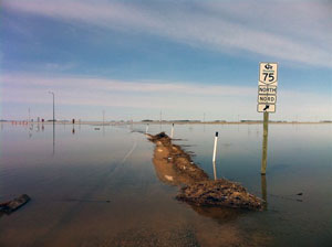
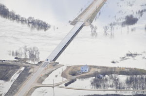
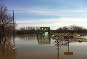
About 7,100 Manitobans were displaced from their homes, with 2,700 still evacuated at the end of the year. Flooding affected three million hectares of farmland, requiring ranchers to move thousands of livestock. Local states of emergency were declared in 70 Manitoba communities. Floodwater forced the closure of 850 roads, including parts of the Trans-Canada Highway. The massive flood fighting effort involved thousands of emergency measures officials and volunteers, including inmates from a local jail and 1,800 members of the Canadian military.
Reports
Please visit the reports page for all Red River Flood Reports


